Slope map for Lapland and Norway
Kilpisjärvi slope map
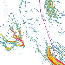
Kilpisjärvi sits in northwestern Finnish Lapland, close to the Norwegian and Swedish borders. The area is known for Saana, open fell terrain, and the wilder Käsivarsi landscape, where slope steepness can quickly change the feel of a route.
Open Kilpisjärvi on the slope map
Kilpisjärvi terrain steepness on the map
Around Kilpisjärvi, the lake, fells, valleys, and open slopes change quickly. The slope map helps show where terrain rises gently and where slopes become clearly steeper.
Using the Kilpisjärvi slope map for route planning
Start with a wide view and look at how fells, water, and valleys sit together. Then zoom toward Saana, nearby fell slopes, or border-area terrain and compare steepness before choosing a route in more detail.
Kilpisjärvi and avalanche terrain
Slope steepness matters in winter, but avalanche risk needs much more than a map. Check official avalanche bulletins, weather forecasts, snow conditions, and local observations. Use this map as one planning aid only.
The map does not replace local knowledge, official warnings, weather forecasts, avalanche bulletins, navigation, or professional judgment.
How to use the Kilpisjärvi slope map
Open the map, zoom to the area you are interested in, and compare several possible lines side by side. Look for places where the terrain becomes steeper quickly and where gentler alternatives might run.
Data sources
The map is based on open land survey data from the National Land Survey of Finland and the Norwegian Mapping Authority. It shows general terrain shape, not current snow, weather, or route conditions.
For Finnish areas, you can also use Hylly map and weather pages as part of your planning:
Open Kilpisjärvi on the map
Explore the slopes and terrain steepness around Kilpisjärvi with the Slope Hylly map. Use it for early comparison of areas and route options before more detailed planning.