Slope map for Lapland and Norway
Saariselkä slope map
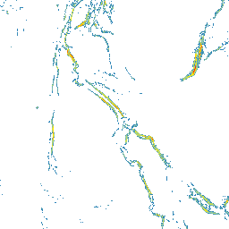
Saariselkä lies in northern Lapland in the Inari area, close to Urho Kekkonen National Park. Its fell scenery, open outdoor terrain, and changing elevation make slope reading useful before route planning.
Open Saariselkä on the slope map
Saariselkä terrain steepness on the map
The Saariselkä slope map helps you see where fell terrain is gentler and where slopes become steeper. It makes it easier to compare climbs, descents, ridges, and slopes around gullies.
Using the Saariselkä slope map for route planning
Zoom to the Saariselkä area and review a route in stages: terrain near the village, fell tops, slopes, valleys, and forested sections. Compare how steepness changes along the way.
Saariselkä and avalanche terrain
Slope steepness matters in winter, but avalanche risk needs much more than a map. Check official avalanche bulletins, weather forecasts, snow conditions, and local observations. Use this map as one planning aid only.
The map does not replace local knowledge, official warnings, weather forecasts, avalanche bulletins, navigation, or professional judgment.
How to use the Saariselkä slope map
Open the map, zoom to the area you are interested in, and compare several possible lines side by side. Look for places where the terrain becomes steeper quickly and where gentler alternatives might run.
Data sources
The map is based on open land survey data from the National Land Survey of Finland and the Norwegian Mapping Authority. It shows general terrain shape, not current snow, weather, or route conditions.
For Finnish areas, you can also use Hylly map and weather pages as part of your planning:
Open Saariselkä on the map
Explore the slopes and terrain steepness around Saariselkä with the Slope Hylly map. Use it for early comparison of areas and route options before more detailed planning.